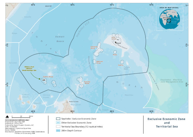
The MSP covers the entire 1,350,000 square kilometers of the Seychelles’ Exclusive Economic Zone (EEZ) and Territorial Sea. The Territorial Sea is about 47,000 square kilometers and accounts for approximately 3.5 percent of the EEZ.
The United Nations Convention for the Law of the Sea (UNCLOS) defines a nation’s EEZ and Territorial Sea. UNCLOS provides a definition for these areas and the sovereign rights that states can exercise over the resources within these waters. Click here for a link to the UNCLOS text. Seychelles is an archipelagic nation so it uses the archipelagic baseline to identify its boundaries.
Territorial Sea – from baseline to 12 nautical miles (22 kilometers)
Exclusive Economic Zone (EEZ) – from 12 nautical miles to 200 nautical miles (maximum)
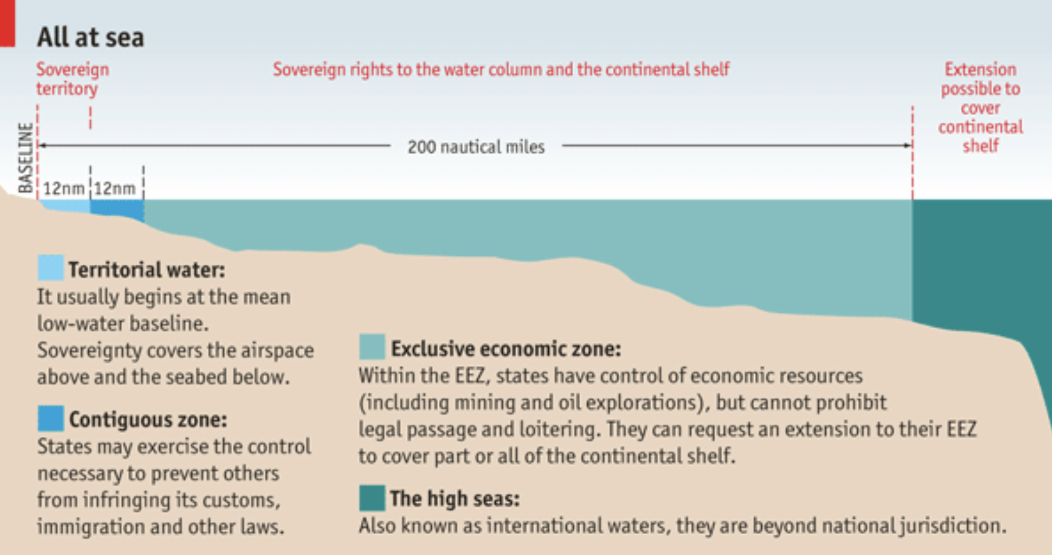
Diagram for Territorial Sea and Exclusive Economic Zone, as defined by UNCLOS. Source: The Economist.
Five themes for the MSP
- FISHERIES: artisanal, semi-industrial, industrial, sport, recreational, aquaculture
- BIODIVERSITY CONSERVATION: habitats, species, ecological processes
- INFRASTRUCTURE AND PUBLIC UTILITIES: ports, renewable energy, maritime security, shipping
- NON-RENEWABLE RESOURCES: petroleum, mining
- TOURISM & RECREATION: marine charters, recreational activities
Planning in Phase 1 is being done at a coarse scale to address broad ecological, economic and social objectives all of Seychelles’ waters. All waters within the Territorial Sea are Interim Zone 2, that is “Medium Biodiversity & Sustainable Uses”.
Planning in Phase 2 will complete the zoning design for the remaining 15% of the 30% marine protected area target, and complete the marine spatial plan for the full 1.37 million square kilometers, including an implementation plan.