
Seychelles Marine Spatial Plan Overview
The Seychelles Marine Spatial Plan (SMSP) Initiative began in 2014. It is a process focused on planning for and management of the sustainable and long-term use and health of the Seychelles’ ocean. Seychelles’ marine waters encompasses 1,350,000 square kilometres and 115 islands in four archipelagoes.
The SMSP Initiative is a Government-led process, with planning and facilitation led by The Nature Conservancy (TNC) in partnership with GoS-UNDP-GEF Programme Coordinating Unit (PCU) and Seychelles Conservation and Climate Adaptation Trust (SeyCCAT).
Funding for the SMSP process is provided by TNC through private grants, the Government of Seychelles, SeyCCAT and other private grants and funders . Funding to support implementation of the MSP will come in part from the Seychelles Conservation & Climate Adaptation Trust (SeyCCAT), operationalised in 2016 as a product of the Seychelles debt swap.
The SMSP Initiative is an integrated, multi-sector approach to address climate change adaptation, marine biodiversity protection and support the Blue Economy and other national strategies. The process has a robust stakeholder engagement framework and includes all major sectors of the Seychelles including commercial fishing, tourism and marine charters, biodiversity conservation, renewable energy, port authority, maritime safety, and no-renewable resources in order to develop a comprehensive marine plan with stakeholder input.
Why a Marine Spatial Plan for the Seychelles?
In 2012, the Government of Seychelles set a goal for protected area expansion:
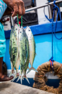
Photo by Jason Houston
50% of all terrestrial areas and 30% of the Exclusive Economic Zone including 15% in ‘fully protected’ areas. At that time, more than 47% of the land was protected and only 0.04% of the ocean. The MSP Initiative uses an ecosystem-based approach to propose new marine protected areas in conjuction with improved management for uses and activities in the 1.35 million square kilometres of ocean. The MSP Initiative uses global best practices, scientific data, local expert knowledge and stakeholder input to create maps showing how we use the ocean and what we know about its ecology.
Marine spatial planning (MSP) is a public process of analysing and allocating the spatial and temporal distribution of human activities in marine areas to achieve ecological, economic and social objectives, usually specified through a political process (UNESCO 2009). Using MSP is a practical, transparent and participatory way to plan for the sustainable use of the Seychelles’ marine space and to balance demands for development with the need to protect the environment.
The Seychelles’ EEZ is among the top 25 largest in the world and Seychelles is a global biodiversity hotspot with two UNESCO World Heritage Sites. Biodiversity is one of the country’s most important assets, supporting fisheries, tourism and local livelihoods. Geological studies indicate that there may be valuable petroleum reservoirs in Seychelles and renewable energy potentials exist near the coast and offshore.
Seychelles MSP is guided by national laws, policies and priorities, as well as national commitments to international policies, conventions and treaties. For example, Article 38 of the Seychelles Constitution declares that: “The State recognises the right of every person to live in and enjoy a clean, healthy and ecologically balanced environment and with a view to ensuring the effective realisation of this right the State undertakes to ensure a sustainable socio-economic development of Seychelles by a judicious use and management of the resources of Seychelles”.
The guiding principles of the Seychelles Sustainable Development Strategy (SSDS) provide an overall goal for the MSP Initiative: develop and implement an integrated marine plan to optimise the sustainable use and effective management of the Seychelles marine environment while ensuring and improving the social, cultural and economic wellbeing of its people.
The MSP is supported by the Seychelles Conservation & Climate Adaptation Trust (SeyCCAT), established as part of the Debt-for-Climate-Change-Adaptation swap. The Ministry of Agriculture, Climate Change and Environment (MACCe) is the lead Ministry for the MSP, with co-leadership of the Executive Committee from Ministry of Fisheries and Blue Economy (MFBE).
Please click here for Frequently Asked Questions (FAQ).
Updated: 2024