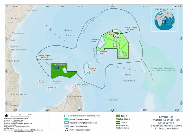
The Seychelles MSP Phase 1 – Milestone 1 marine areas were legally designated on 21 Feb 2018. The Milestone 1 areas meet the 15% marine protection goal and the conditions of the Seychelles debt conversion. See Seychelles Conservation and Climate Adaptation Trust (SeyCCAT).
This page contains the information related to these gazetted areas including the gazetted maps for the new marine protection areas designated under the National Parks and Nature Conservancy Act (NPNCA). The zones designated during the MSP process will be implemented in 2021, on completion of the marine spatial plan.
IMPORTANT INFORMATION
The marine spatial plan is an on-going process to identify marine zones and allowable activities for all marine waters in Seychelles. The marine zones are gazetted at intervals during the process as per conditions of the debt swap. The allowable activities, management plans, regulations, monitoring, and other aspects of enforement for the marine zones will be implemented and begin in 2021.
DOCUMENTS
- SMSP draft Marine Spatial Plan: Phase 1 designation areas (8.9 MB PDF)
- Map: SMSP Phase 1 – Zones 1 and 2 (3.1 MB PDF)
- Map: SMSP Phase 1 – Zone 1 (Aldabra Group) (2 MB PDF)
- Map: SMSP Phase 1 – Zone 2 (Amirantes to Fortune Bank) (1.4 MB PDF)
- List of stakeholder meetings and participants 2014-2017
Documents provided for information and discussion purposes only.
Subject to change upon review and revision. Subject to government approval.
Updated: 17 May 2019