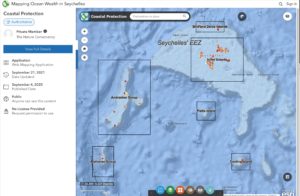
The Nature Conservancy’s Mapping Ocean Wealth team has completed a more than one year project to evaluate ecosystem services in the context of Seychelles marine protection areas. This project was led and supported by the Ministry Agriculture, Climate Change and Environment (MACCE) and the World Bank SWIOFish3 programme.
The purpose of this study was to quantify the ecosystem goods and services provided by Seychelles Protected Area System. All maps and data are available from the Mapping Ocean Wealth in Seychelles Online Map Viewer and Data Catalog.
The Final Report will be posted soon!
Key findings from this study include the following:
- In Seychelles, approximately 90% (1,149 km) of shorelines benefit from protection by fringing coral reefs, with 77% (889 km) of these shorelines located in or adjacent to protected areas. Most of the latter, however, are far from human habitation and of the 44,280 people who live in low-lying (<30m) coastal areas only about 18% receive risk reduction from reefs that fall within protected areas.
- Every protected area in Seychelles contains blue carbon from either seagrass, mangroves, or both, with the total sum of blue carbon found in protected areas estimated to be 156.7 million metric tons (Mt). The numbers are dominated by the contribution of seagrasses most notably from the Mahé Plateau.
- Within Seychelles, we estimate that coral reefs are generating US$51.5 million annually from on-reef activities such as snorkeling and diving and that these activities generate the equivalent of 30,156 visitors to the Seychelles.
- Natural values of the beaches in Seychelles are estimated to be generating a combined total of US$160 million of tourism expenditure annually with 94,000 visitors who are attracted specifically to the natural aspects of Seychelles’ beaches.

The Nature Conservancy – Mapping Ocean Wealth
